Travels With My Camera

The World Through My Camera Lens

  • About

Stellenbosch

Posted by raytheron on November 17, 2017
Posted in: Uncategorized. 2 Comments

Stellenbosch, South Africa’s second-oldest town, is a university town some 50km east of Cape Town. It’s known for its stunning old oak trees, some of them planted in the 17th century, which is why it’s also known as the “Eikestad” (Town of Oaks). The town has an incredible amount of fond memories for me: this is where I attended the University of Stellenbosch between 1973 and 1976, where I met my first wife and our eldest was born, and where I taught English at the prestigious Paul Roos Gymnasium boys’ high school for 24 years. It is a wonderful old town, vibrant, atmospheric, colourful and beautiful.

The images that follow were made during a very brief visit in 2016, when I flew in from Sydney to attend the mass reunion of Old Boys (alumni) to mark the school’s 150th birthday. Words will never be able to express my gratitude to the Old Boy who so generously paid my airfare. But that’s the quality of alumnus Paul Roos produces…


stb01-001

This lovely old building on Ryneveld St was where the Bloemhof Girls’ High School started.


stb02-002

Right on the corner of Rynveld and Victoria Sts and in front of the men’s residence Wilgenhof stands this massive old eucalypt. I spent many a pleasant hour sitting on its roots and chatting with friends.


stb02-003

The Wilcox Building in my day housed all but two of the departments I was a student of. Afrikaans-Nederlands, English and French lectures and tutorials were all held here, so I spent most of my time either in or in front of this building. General Linguistics and German offered most of their classes in their own buildings.


stb02-004

The Old Main Building of the university, directly opposite the Wilcox.


stb02-005

The old Music Conservatory on Van Riebeeck St. I used to enjoy walking through the grounds and listening to the music students practising on their instruments.


stb02-006

Another favourite building from my students days, but for a different reason! The Van der Stel bottle store on Andringa St was where I bought my wine.


stb02-007

The Department of General Linguistics was housed in this former house on Merriman Avenue.


stb02-008

I rented a room in this house on De Beer St between 1973 and 1976.


stb02-009

The walkway behind the Administration Building wasn’t as shady in my time.


stb02-010

The north entrance to the Wilcox Building. Two of the ground-floor windows on the far right belong to the room which housed the Molteno Reading Room, a kind of mini-library and a resource centre for the Dept. of English where I served as supervisor in my third year.


stb02-011

The former C L Marais Library on Crozier St. This building housed the Dept. of Archaeology in my day. I was often tempted to switch from a languages degree to one in archaeology…


stb02-012

The Theological Seminary at the top end of Dorp St is where Dutch Reformed ministers are trained. A beautiful old building, like most of the town’s older structures.


stb02-013

Die Laan (The Avenue) runs along the northern bank of the Eerste River, and was where courting student couples used to saunter and spend romantic moments.


stb2016-001

The entrance to the grounds of the Lanzerac Hotel on the eastern edge of town. The hotel uses most of the original buildings of the farm established here in 1692. It’s also a wine estate bottling some trule great wines.


stb2016-002

The main building on the estate.


stb2016-003

And from closer. Note the typical Cape Dutch architecture and the thatched roof.


stb2016-004

A serene, shady spot for a drink on a warm day.


stb2016-005

Stellenbosch Mountain as seen from the Lanzerac driveway.


stb2016-006

The drive is lined with young London planes.


stb2016-007

A typical Western Cape scene: mountains and vineyards.


stb2016-008

Looking towards the Hottentotots-Holland mountains.

Cape Town – Muizenberg to Simonstown

Posted by raytheron on December 1, 2016
Posted in: Cape Peninsula, Cape Point, Cities, Cities of the World, Fairest Cape, Landscapes, Mother City, South Africa, Tourist routes of the Cape, Travel, Uncategorized, Western Cape. Tagged: Cape Town, False Bay, Muizenberg, Photography, Simonstown, Southern Suburbs, travel. 2 Comments


Images from this part of the southern suburbs of Cape Town. The places you see below are all on the way to Cape Point if you take the eastern route to the point from the city centre, or from any of the southern suburbs like Rondebosch, Mowbray, Rosebank, Pinelands and the like. Please keep in mind that these images were made during our 2012 visit, so things may have changed since then.


dsc_0259

From the eastern part of Muizenberg beach one has this view across False Bay towards Cape Hangklip on the horizon.


dsc_0260

Eager customers waiting for the beaching of the snoek boats with their catches of fresh snoek  (Thyrsites Atun), a delicacy much loved by the people of the Western Cape.


dsc_0261

Two Greater Black-backed gulls wait patiently, too!

dsc_0262

Looking towards Cape Point. The point itself is on the far left of the headland.

dsc_0264

Muizenberg beach, with the town itself nestled up against the mountainside on the right.

dsc_0265

Looking towards Simonstown.

dsc_0269

Towards the southeastern end of town we find the old houses built on the hillside and overlooking False Bay. The building with the clock tower is the railway station.

dsc_0272

Looking in the direction of St James, just around the point.

dsc_0274

The western end of the beach.

dsc_0276

Most of Muizenberg’s older buildings have been retained and now house new businesses.

dsc_0277

Quirky colour scheme on the Roxy Building.

dsc_0278

Muizenberg also has its colourful bathing houses, but those at St James are thought to be even better looking.

dsc_0279

A trawler heads heads, probably just having left Kalk Bay harbour.

dsc_0285

An eclectic assortment of goods for sale at the Kalk Bay Trading Post.

dsc_0286

The seemingly plain facebrick facade hides a real treasure trove, but it’s almost lunch time, so we head on by…

dsc_0290

Fresh snoek in Kalk Bay harbour.

dsc_0295

The harbour itself is quite empty, with most of the fishing fleet out at sea for the day.

dsc_0296

St James in the distance, with Fish Hoek just peeping out from behind the mountain. The Simonstown is on the far left.

dsc_0303

A modest entrance to an emporium of bakery delights in Kalk Bay.

dsc_0304

Looking up the steep, short Colyn Road in Kalk Bay.

dsc_0315

And so we arrived in Simonstown. This is a small section of the yacht marina. Off shot to the right lies the naval base which played such a strategic role to protect the sea route past the Cape during two world wars and the Cold War.

dsc_0316

Lunch stop! Freshly fried snoek for me, and fresh chips (what some call fries) for me. Oh, the simple delights of being in such a wonderful place!


Sete Cidades, São Miguel, Azores

Posted by raytheron on October 12, 2016
Posted in: Azores, History, Landscapes, Portugal, São Miguel, Travel, Uncategorized. Tagged: Azores, caldera lakes, lakes, Photography, Portugal, São Miguel, Sete Cidades, tour, tourism, travel, vacation. 2 Comments

The name Sete Cidades refers to the caldera of the dormant volcano in the western part of the island of  São Miguel, as well as the village on the shore of the caldera lake.

The name derives from the Latin Insula Septem Civitatum (Island of the Seven Communities/Peoples), a reference to a Latin chronicle from the city of Porto-Cale (the modern city of Porto), written in 750 A.D. by a Christian cleric. During this era, the Iberian Kingdom of the Visigoths was in the process of collapse because of the  Muslim invasions (which began in 711 A.D.) The Visigoth archbishop fled to Porto-Cale, fearing the assault of the Muslim forces, from whence he planned an escape to the lands in the Western Sea, which sailors firmly believed existed. In 734, the archbishop, accompanied by six other bishops, their prelates and approximately 5000 faithful, sailed away in a fleet of twenty ships. The chronicle indicated that the fleet arrived at their destination, burned their ships and established seven Christian communities under the reign of the seven religious leaders. Although many prepared to follow, in truth, the archbishop (if he existed) was never heard from again, nor was the route to the mythical lands established. Myth has it that the “Western Islands” were in fact the Azores. However, there are no traces at all of any inhabitants prior to the arrival of the first discoverer, the Portuguese voyager Gonçalo Velho Cabral, in 1427. The term civitatum later became confused with civitas (city), which replaced the earlier urbs.

The caldera is that of a dormant volcano, the last eruption having taken place in the 15th century, around the time the island was discovered. There have been the occasional seismic events, but nothing presenting any danger to the area and its inhabitants.

Today Sete Cidades is the smallest civil parish in terms of population (around 800) of the island, but the largest in area (approximately 20 km²). The caldera is home to the largest caldera lake on the island, the Lagoa das Sete Cidades. It is in fact a twin lake, although the waters mingle. The larger is the Lagoa Azul (Blue Lake) and the smaller the Lagoa Verde (Green Lake) The names refer to the way the two bodies of water reflect sunlight.

There are two other, smaller lakes in the caldera, the Lagoa Rasa and the Lagoa de Santiago. Both are isolated, mystical places of utter peace and quiet.

It is an area of breathtaking beauty and serenity, and visiting Sete Cidades is a truly unforgettable experience.

sc001

Probably the most scenic approach to the caldera is from the south-east along the Arrifes – Covoada road. This road ascends the Pico do Carvão, from which one has a breathtaking view of the north coast and central part of the island.


sc002

This is the view from the best viewpoint by the roadside, the Miradouro da Vista do Rei. Here one can clearly see the Lagoa Verde in the foreground and the Lagoa Azul beyond, as well as the bridge that separates the two.


sc003

From the same vantage point we can also see the village of Sete Cidades.


sc004

This is a better look at the Lagoa Verde.


sc005

Looking across the Lagoa Azul towards the west.


sc006

There are a few scattered holiday cottages on the shores of the Lagoa Azul, and a few farms, too.


sc007

The small cottage on the right and closest to the shore in this view is the one in which I woke up on the morning of January 1st, 2000. It is so quiet here that I could hear the priest in the parish church, about a kilometre away! The three weeks I stayed here were simply amazing. 


sc008

This boathouse is one of the most photographed buildings in the caldera, after the church.


sc009

A closer view of the boathouse.


sc010

The view looking northwest from the bridge.


sc011

The place is one of the greenest I have ever been in. No wonder one’s eyes are soothed, as is one’s soul.


sc012

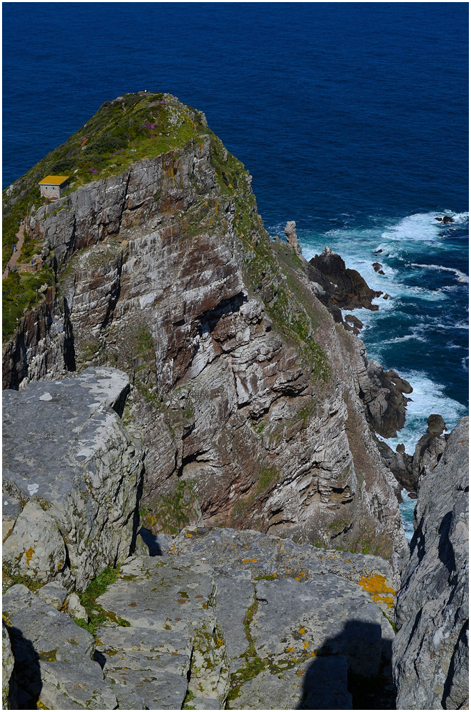
The caldera wall is quite precipitous in places.


sc013

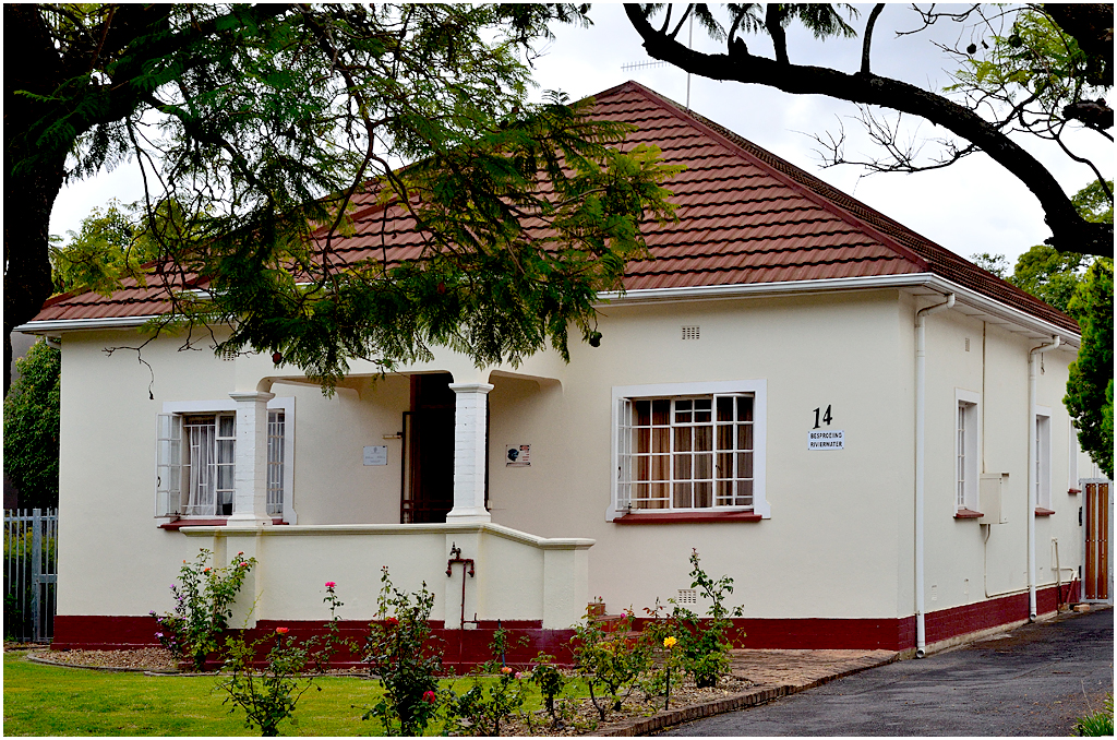
This little house is fairly typical of the homes in the village, as well as the island in general.


sc014

The parish church, the Igreja de São Nicolau.

To Villiersdorp!

Posted by raytheron on September 20, 2016
Posted in: Fairest Cape, History, South Africa, Tourist routes of the Cape, Travel, Uncategorized, Western Cape. Tagged: Cape apples, Cape mountains, De Villiers-Graaf, Grabouw, South Africa, Theewaterskloof, tourism, travel, vacation, Villiersdorp, Western Cape. Leave a comment

The small town of Villiersdorp in the Western Cape lies close to my heart. This is where I finished my school career in 1969 when I matriculated from the De Villiers Graaff High School. I spent my last two school years here and thoroughly enjoyed them.

The town has its roots in the farm established here in 1843 by one Pieter de Villiers. A village soon shot up. Scandal struck when the daughter of Pieter De Villiers married a farm labourer named Petrus Graff.  The marriage was allowed on condition that the De Villiers name would not be lost.  The couple had three sons, the most eminent of whom was Sir David de Villiers-Graaf, who became a Member of Parliament. He was created a baronet in 1911 and served as Minister of Public Works and of Posts and Telegraphs (1911–1912), Minister without Portfolio (1912–1913), and Minister of Finance (1915–1916). David de Villiers Graaff was also an astute businessman and amassed a considerable fortune, some of which he used to finance the South African war effort during WW I (for which he was knighted).

Sir De Villiers-Graaff  financed the building of the De Villiers-Graaff High School in Villiersdorp in 1907, establishing a £100 000 endowment fund for the school.

Today the town has around 10 000 inhabitants and lies in an area renowned for its deciduous fruit, as well as wines. The large Theewaterskloof Dam built on the Sonderend River just outside town in 1978 today covers an area of around 5 059 ha and contains about 480 million cubic litres of water. Its catchment area is approximately 500 square km.

dsc_0215

Heading north on the R321 from Grabouw, we drive through lush farmland and apple and other deciduous fruit orchards.

dsc_0216

Soon the road starts climbing and we are on rise to the short, but fairly steep Viljoens Pass.

dsc_0217

The clouds lie low on the mountains.

dsc_0219

Looking northeast from the top of the pass. In the distance one can see the Theewaterskloof Dam.

dsc_0220

Zooming in, we get a better view of the dam. The area between the pass and the dam is famous for its top quality apples, grown mostly for export.

dsc_0221

Looking into the mountain from the viewpoint at the top of the pass.

dsc_0222

As we near Villiersdorp the Theewaterskloof Dam lies close, and the road actually crosses a section of the dam via a bridge.

dsc_0225

Looking southeast from the bridge.

dsc_0226

Villiersdorp as seen from the hillside above the school (which is off camera to the left).

dsc_0228

Looking across the deep valley to the mountains on the south.

dsc_0230

The lovely little Anglican church in the town.

dsc_0232

When the town was originally laid out, Pieter de Villiers planted many oak and eucalyptus trees. Today some of the streets are lined with stately London plane trees.

dsc_0233

An old house in town with the thatched roof so popular in this part of the Western Cape.

dsc_0237

As we leave Villiersdorp in the direction of Franschhoek, we drive along the dam again.

dsc_0238

A serene little island in the dam.

dsc_0239

As in just about everywhere in the Western Cape, the mountains are always close, and particularly atmospheric on the day we were there.

Cape Point, Cape Town, South Africa

Posted by raytheron on August 14, 2016
Posted in: Cape Peninsula, Cape Point, Fairest Cape, History, Landscapes, Mother City, South Africa, Tourist routes of the Cape, Travel, Uncategorized, Western Cape. Tagged: Bartholomeu Dias, Cape beaches, Cape mountains, Cape Point, Cape Town, False Bay, old lighthouse, Portuguese explorers, Sea route to India, South Africa, tourism, travel, vacation, Vasco da Gama, Western Cape. 1 Comment

The south-westernmost tip of the continent of Africa is known as Cape Point. The first European to sight (and round) the point was the Portuguese explorer Bartholomeu Dias, who rounded Cape Point in January 1488. His little flotilla of two ships were hit by storms when they were close to the Point and he named the place Cabo Tormentoso (Cape of Storms). Cape Point and False Bay beyond it on the eastern side of the peninsula are notorious for the autumn northwesterly gales and the ferocious south-easterlies in summer. João II, king of Portugal (1455-1495), later renamed the cape Cabo de Boa Esperança (Cape of Good Hope), because rounding the Cape ultimately served to open the only sea route to the East and its riches at the time.

The next Portuguese explorer to round the Cape was Vasco da Gama, who sailed past Cape point in a gale on November 22nd, 1497. He was the first Portuguese to reach India by sea. Today he is remembered at Cape Point by having the tallest peak named after him.

Today the cross-shaped padrão (a limestone marker used by the Portuguese explorers to mark their landing sites) one can see near the point is  in fact a replica. The original, the Padrão de São Filipe, is thought to have been erected closer to the Point on the headland known as Cape Maclear, just north-west of the point itself.

Cape Point remains one of the most significant headlands in the history of the world, and it is widely regarded as one of the most beautiful points in the world. The English sea captain and explorer Sir Francis Drake, who rounded the Cape on the 18th of July 1580, called it “a most stately thing and the fairest cape we saw in the whole circumference of the earth”. To this day the Cape Peninsula and Cape Town are commonly referred to as “the Fairest Cape”.

Our visit to Cape Point in 2012 was on a bright, sunny and almost windless day.

cp001

The marker that greets one at the start of the track leading up to the old lighthouse.

cp002

The view along the eastern side of the peninsula towards Cape Point. The highest peak visible is Vasco da Gama Peak.

cp003

Looking north along the western side of the peninsula (looking back towards Cape Town, in other words).

cp004

Looking down on Smitswinkels Bay from the whale-watching viewpoint on the eastern side of the peninsula. The mountains on the horizon are on the far side of False Bay.

cp005

The view south from the same vantage point.

cp006

The coast is rocky and rather inhospitable, but beautiful, too.

cp008

Looking out across False Bay towards the Hottentots-Holland and Steenbras Mountains and Cape Hangklip on the eastern shore of the bay.

cp009

The old lighthouse was constructed in 1859 and is sited on the highest point of the ridge between Vasco da Gama Peak and the Point itself.

cp010

Cape Maclear, just north-west of the Point. It is here that Dias is thought to have planted his Padrão de São Filipe in 1488.

cp012

Dias Beach and Cape Maclear.

cp013

Looking north from the old lighthouse. Vasco da Gama Peak is the nearest to the camera.

cp014

A wider view in the same direction, with Table Mountain and Devils Peak in the far distance.

cp015

There is a well-constructed and beautifully maintained walkway down to a vantage point just above the sea here.

cp016

Cape Point itself, looking south. I took a photo from the edge of the flat rock in the foreground back in 1970, but was a bit more cautious this time!

cp017

Looking north, the old lighthouse just visible on top of the ridge.

cp019

Another view of Cape Point.

cp020

Even on a calm day the surf is quite ferocious. The waves breaking here have travelled unimpeded from the coast of South America!

cp021

The Point and the new lighthouse, built in 1914.

cp022

The new lighthouse is the most powerful on the coast of South Africa.

cp023

Looking back at the old lighthouse.

cp024

A last long look over False Bay before we bid Cape Point adieu…

São Miguel – More Views

Posted by raytheron on July 24, 2016
Posted in: Uncategorized. Leave a comment

The images in this blog were all made during our 2012 visit to the Azores, and are of places in the city and  on our walk back from Pópulo to Ponta Delgada.

DSC_0896

Between the Avenida Dom Infante Henrique and the waters of the harbour: this stretch of restaurants, coffee shops and bars are all part of the improvements and extensions made to the Avenida.

DSC_0903

The Baptista de Andrade is one of the Portuguese Navy’s eponymous class of corvettes and was stationed at Ponta Delgada during its stint protecting Azorean waters from illegal fishing fleets. This particular vessel has since been decommissioned.

DSC_0905

Looking across the bay between Ponta Delgada and São Roque towards the Serra Água de Pau. The Rosto do Cão headland is in the middle distance.

DSC_0914

Looking down the Rua Manuel Inácio Correia, one of the city’s many lovely medieval streets.

DSC_0922

The Praça do Município with the Câmara Municipal (municipal offices).

DSC_0927

Rua da Cruz and a typical little coffee shop.

DSC_0929

The Igreja de São José on the Campo de São Francisco, Ponta Delgada.

DSC_0942

Fishing boats in the harbour of Ponta Delgada.

DSC_0947a

Many of the old houses in this city date back to the early 16th century, and even in their decays are still beautiful.

DSC_0953

Rosto do Cão (face of the dog) seen from a bit closer.

DSC_0963

Looking across Ponta Delgada harbour, with the Centro Sol Mar shopping centre and apartments on the left and the Hotel Açores Atlantico on the right.

DSC_0978

Praia das Milicias, Pôpulo.

DSC_0980

Facade of the church of São Roque.

DSC_0981

The little bay in front of the São Roque church.

DSC_0987

Beautiful tile work, called azulejos, is typical of Portuguese buildings, even modest houses.

DSC_0991

A narrow little street in São Roque, a poor parish on the outskirts of the city of Ponta Delgada.

DSC_0992

São Roque shoreline.

DSC_0998

A view across São Roque.

DSC_1001

Looking towards Ponta Delgada and one of the hundreds of cruise ships that call here every year.

DSC_1006

The hills above Ponta Delgada.

DSC_1007

The next land from this viewpoint is Antarctica!

DSC_1013

Close view of the Rosto do Cão.

DSC_1028

I could not resist capturing this image!

More Cape Town

Posted by raytheron on June 23, 2016
Posted in: Cape Peninsula, Cities, Cities of the World, Fairest Cape, History, Landscapes, Mother City, South Africa, Travel, Western Cape. Tagged: Cape mountains, Cape Town, Company Gardens, South Africa, tourism, travel, vacation, Western Cape. Leave a comment


A few more images from Cape Town’s central area taken during our visit in 2012. Of note is the Company Gardens, established shortly after Jan van Riebeeck’s arrival at the Cape in 1652. The gardens were laid out to provide fruit and vegetables for ships of the Dutch East India Company (hence the Company Gardens), since the reason for the early Dutch settlement here was to establish a refreshment post for the Company’s ships. Today the Gardens are more of a botanical garden.


DSC_0694

On the corner of Orange and Hof Streets

DSC_0695

The entrance to the iconic Mount Nelson Hotel on Orange Street

DSC_0696

Looking down Government Lane from the Orange Street end

DSC_0698

The Company Gardens has plenty of these cute little grey squirrels

DSC_0708

Another grey squirrel

DSC_0700

The National Art Gallery

DSC_0701

The South African Museum and Planetarium

DSC_0702

The rose garden in the Company Gardens

DSC_0707

A glimpse of Table Mountain from a quiet nook of the Company Gardens

DSC_0713

Even in the middle of the city there are charming little sights like this

DSC_0716

Greenmarket Square nowadays is swamped with stalls selling tourist-trap knickknacks brought in from the rest of Africa

DSC_0718

Cape Town has retained many of its charming Victorian buildings, which now stand side by side with much more modern buildings

DSC_0721

Lovely detail on a street corner

DSC_0745

A whimsical balcony


Between the Strand and Onrus

Posted by raytheron on July 23, 2015
Posted in: Uncategorized. Tagged: Bettys Bay, Botrivier, Botrivier Vlei, Cape mountains, False Bay, Fisherhaven, Gordon's Bay, Hangklip, Helderberg, Hermanus, Kleinmond, Onrus, Palmiet, Pringle Bay, Strand, Walker Bay, Western Cape. Leave a comment

Between the Strand and Onrus, about 80km away, the Faure Marine Drive or R44 takes one through lovely seaside towns like Gordons Bay, Rooi Els, Bettys Bay, Kleinmond and Fisherhaven. The R44 runs into the R43 near Botriver, and that in turn runs past Fisherhaven on the Botriver Vlei, Hawston and Vermont to Onrus. The images in this blog come from our drive along this route to Onrus and back in 2014.

The view  northwest from the R44 just outside Gordons Bay. The Strand is off camera to the left. In the distance lie the Hottentots-Holland Mountains.

The view northwest from the R44 just outside Gordons Bay. The Strand is off camera to the left. In the distance lie the Hottentots-Holland Mountains.

Looking southwest across False Bay towards the Swartkop Mountains on the peninsula leading to Cape Point.

Looking southwest across False Bay towards the Swartkop Mountains on the peninsula leading to Cape Point.

Part of Gordons Bay, with Bikini Beach closest to the camera  and the harbour on the left.

Part of Gordons Bay, with Bikini Beach closest to the camera and the harbour on the left.

Kogelbaai, looking towards Cape Hangklip.

Kogelbaai, looking towards Cape Hangklip.

Kleinmond beach: the view across towards the Hermanus, with the Babilonstoring, Kleinrivier and Franskraal mountains on the horizon.

Kleinmond beach: the view across towards the Hermanus, with the Babilonstoring, Kleinrivier and Franskraal mountains on the horizon.

Another view of the Kleinmond beach.

Another view of the Kleinmond seafront.

Botriver Vlei is an estuary lagoon in the Bot River. Here we are looking northeast towards the village of Botrivier.

Botriver Vlei is an estuary lagoon in the Bot River. Here we are looking northeast towards the village of Botrivier.

Looking at the Palmiet mountains across Botriver Vlei (A "vlei" in Afrikaans can be a swamp, any stretch of shallow water or a lagoon.)

Looking at the Palmiet mountains across Botriver Vlei (A “vlei” in Afrikaans can be a swamp, any stretch of shallow water or a lagoon.)

A moody sky over the Palmiet mountains.

A moody sky over the Palmiet mountains.

Late afternoon sun on the Botriver Vlei.

Late afternoon sun on the Botriver Vlei.

Tidal flats at sunset.

Tidal flats at sunset.

Dramatic scenery is common on the Vlei at this time of the year (late winter).

Dramatic scenery is common on the Vlei at this time of the year (late winter).

Dark clouds gather...

Dark clouds gather…

I love winter in the Cape.

I love winter in the Cape.

Looking across the Vlei towards the Atlantic Ocean.

Looking across the Vlei towards the Atlantic Ocean.

The peaks of the Palmiet mountains above Kleinmond.

The peaks of the Palmiet mountains above Kleinmond.

The beach, Onrus, looking across Walker Bay towards Gansbaai and the Franskraal Mountain.

The beach, Onrus, looking across Walker Bay towards Gansbaai and the Franskraal Mountain.

En route back to the Strand. Cape Hangklip on the horizon.

En route back to the Strand. Cape Hangklip on the horizon.

Sunset drive along the Faure Marine Drive with the Blousteen and Kogelberg mountains  towering over False Bay.

Sunset drive along the Faure Marine Drive with the Blousteen and Kogelberg mountains towering over False Bay.

Another view of this stunningly scenic drive, matched only by Chapmans Peak Drive for beauty.

Another view of this stunningly scenic drive, matched only by Chapmans Peak Drive for beauty.

Late sun paints the mountains.

Late sun paints the mountains.

Looking across False Bay towards the Strand from Gordons Bay.

Looking across False Bay towards the Strand from Gordons Bay.

Back in our holiday apartment and the night view across the Strand towards Somerset West and the Helderberg Mountain beyond.

Back in our holiday apartment and the night view across the Strand towards Somerset West and the Helderberg Mountain beyond.

Amesbury, Wilts. England

Posted by raytheron on May 2, 2015
Posted in: Uncategorized. Leave a comment

Amesbury is a delightful English village about 120km southwest of London and a mere three kilometres from the famous Stonehenge. The surrounding countryside as typically English: green and lush and interesting. This village on the River Avon is recognized as the oldest continuously occupied UK settlement. Nearby is also the lesser-known Woodhenge, another Neolithic settlement similar to the one discovered at Boscombe Down.

Amesbury is also conveniently close to Salisbury, and is the burial place of Eleanor of Provence, who was buried here in 1291. The village church is remarkable for the fact that it houses a clock, thought to have been made for the nearby Benedictine Abbey in the 16th cent., that originally had no hands, as it was used only mark the hours of worship.

It’s a beautiful village, filled with wonderfully friendly people and it has some great pubs!

The River Avon near the village.

The River Avon near the village.

A typical country scene.

A typical country scene.

Beautiful English houses near the river.

Beautiful English houses near the river.

Another view of the Avon.

Another view of the Avon.

Lord's Walk is just outside the village and offers a delightful stroll along the banks of the Avon.

Lord’s Walk is just outside the village and offers a delightful stroll along the banks of the Avon.

The gatehouse of the Benedictine Abbey. Today the abbey houses a nursing home.

The gatehouse of the Benedictine Abbey. Today the abbey houses a nursing home.

The Greyhound.

The Greyhound.

A cottage in the village.

A cottage in the village.

Autumn splendour.

Autumn splendour.

Queensberry Bridge over the Avon.

Queensberry Bridge over the Avon.

Looking down High Street, with the George on the left, and the New Inn on the right.

Looking down High Street, with the George Hotel on the left, and the New Inn on the right.

The George.

The George.

Cape Town – The Fairest Cape or The Mother City

Posted by raytheron on February 20, 2015
Posted in: Cape Peninsula, Cities, Cities of the World, Fairest Cape, History, Mother City, South Africa, Travel, Uncategorized, Western Cape. Tagged: Adderley Street, Bellville, Bo-Kaap, Cape Town, Cape Town Castle, Cape Town Town Hall, Devils Peak, Dirbanville, foodies, Garden, Lions Head, Long Street., Malay slaves, Oranjezicht, Signal Hill, South Africa, Standard Bank, Table Mountain, Tamboerskloof, tourism, tourist destinations, Tygerberg Hill, V&A Waterfront, Vredehoek, Western Cape. 4 Comments

The oldest indications of human settlement at this, the southwestern-most tip of the African continent, date back to around 15-20 000 years ago. Prior to the arrival of the first Europeans, the area was inhabited by groups of nomadic Khoi peoples. The first recorded visit by a European is that of the Portuguese explorer Bartolomeu Dias, who arrived here in 1486 whilst endeavouring to reach the East Indies. The first major settlement by Europeans, however, dates to 1652, when on the 6th of April Jan van Riebeeck landed to start a refreshment post for Dutch ships passing the Cape en route to the Indies, as instructed by his superiors the Heere XVII, the Dutch council responsible for Dutch Colonies.

Today Cape Town is the second-largest city in South Africa after Johannesburg. Its metropolitan population of 3,8 million places it is the same category as Los Angeles and Yokohama. The Cape Peninsula (the city and it’s immediate surroundings, as well as Table Mountain and Cape Point) draws the bulk of both domestic and international tourists and is much loved for its mild Mediterranean climate, its spectacular scenery, its outstanding world-class wines, its cosmopolitan air and mouthwatering food. It’s a city for people who love to live to the full, who enjoy the very finest life can offer and who enjoy being close to Nature.

The city centre as seen from Signal Hill.

The city centre as seen from Signal Hill.

Looking east over the  northern suburbs like Bellville and Durbanville towards the distant mountain range beyond which the interior starts. The hill on the left is Tygerberg Hill.

Looking east over the northern suburbs like Bellville and Durbanville towards the distant mountain range beyond which the interior starts. The hill on the left is Tygerberg Hill.

The entrance to the Castle of Good Hope.  Built by the Dutch East India Company between 1666 and 1679, the Castle is the oldest existing building in South Africa. It replaced an older fort called the Fort de Goede Hoop which was constructed from clay and timber and built by Jan van Riebeeck upon his arrival at the Cape of Good Hope in 1652

The entrance to the Castle of Good Hope. Built by the Dutch East India Company between 1666 and 1679, the Castle is the oldest existing building in South Africa. It replaced an older fort called the Fort de Goede Hoop which was constructed from clay and timber and built by Jan van Riebeeck upon his arrival at the Cape of Good Hope in 1652.

The old Town Hall, Cape Town, as seen from the Grand Parade. This  large Edwardian building  was built in 1905. It is located on the Grand Parade to the west of the Castle and is built from honey-coloured oolitic limestone imported from Bath in England.

The old Town Hall, Cape Town, as seen from the Grand Parade. This large Edwardian building was built in 1905. It is located on the Grand Parade to the west of the Castle and is built from honey-coloured oolitic limestone imported from Bath in England.

Flower sellers on Adderley Street. The flower sellers have been operating from this position for at least a century and form an integral part of Cape Town's attractions.

Flower sellers on Adderley Street. The flower sellers have been operating from this position for at least a century and form an integral part of Cape Town’s attractions.

The imposing entrance to the Standard Bank Building.

The imposing entrance to the Standard Bank Building.

The Standard Bank building on Adderley Street . Designed by Charles Freeman, the building was completed in 1881. In 1922 two more storeys were added.

The Standard Bank building on Adderley Street . Designed by Charles Freeman, the building was completed in 1881. In 1922 two more storeys were added.

The beautiful blend of old and new which is Cape Town.

The beautiful blend of old and new which is Cape Town.

On the corner of Bloem and Long Streets, looking along the latter. Long Street is lined with beautifully preserved old Victorian buildings and a hub for nightlife.

On the corner of Bloem and Long Streets, looking along the latter. Long Street is lined with beautifully preserved old Victorian buildings and a hub for nightlife.

The V&A is abuzz 24/7, all year round.

The V&A is abuzz 24/7, all year round.

Looking northeast and out into Table Bay.

Looking northeast and out into Table Bay.

Inside the Victoria Wharf shopping centre at the V&A Waterfront.  With over 450 retail outlets selling everything from fashion, home-ware and curios, to jewellery, leather goods and audio-visual equipment. The Waterfront is also still a working harbour and the fishing boats can be seen working bringing in fresh fish or the large container ships being towed in by the tugboats. The Waterfront is Cape Town's premier entertainment venue and home to many outstanding restaurants.

Inside the Victoria Wharf shopping centre at the V&A Waterfront.
With over 450 retail outlets selling everything from fashion, home-ware and curios, to jewellery, leather goods and audio-visual equipment,  the Waterfront is also still a working harbour and the fishing boats can be seen working bringing in fresh fish or the large container ships being towed in by the tugboats.
The Waterfront is Cape Town’s premier entertainment venue and home to many outstanding restaurants.

The V&A Waterfront with Table Mountain and Lions Head in the background.

The V&A Waterfront with Table Mountain and Lions Head in the background.

Fishing trawlers in the working docks of the Victoria and Albert Waterfront.

Fishing trawlers in the working docks of the Victoria and Albert Waterfront.

A glimpse of the colourful houses of the Bo-Kaap (Upper Cape). This area was previously known as the Malay Quarter, because this is where slaves from Malaya settled in the eighteenth century. The minaret of the mosque is indicative of the strong Muslim character of the people of the Bo-Kaap.

A glimpse of the colourful houses of the Bo-Kaap (Upper Cape). This area was previously known as the Malay Quarter, because this is where slaves from Malaya settled in the eighteenth century. The minaret of the mosque is indicative of the strong Muslim character of the people of the Bo-Kaap.

Looking down on part of the suburb of Sea Point.

Looking down on part of the suburb of Sea Point.

Lions Head on the right, as seen from Signal Hill, with the westerly edge of Table Mountain (and the upper cableway station on top) on the right. Between them we see the mountain range known as the Twelve Apostles.

Lions Head on the right, as seen from Signal Hill, with the westerly edge of Table Mountain (and the upper cableway station on top) on the right. Between them we see the mountain range known as the Twelve Apostles.

A wider view to the east, with the Durbanville Hills on the far right.

A wider view to the east, with the Durbanville Hills on the far right.

Another view of the CBD with the harbour on the left and the Royal Cape Yacht Club's marina in the top left corner. Much of the land in this view has been reclaimed from the sea.

Another view of the CBD with the harbour on the left and the Royal Cape Yacht Club’s marina in the top left corner. Much of the land in this view has been reclaimed from the sea.

Devils Peak, and below it the suburbs of Oranjezicht, Gardens, Vredehoek, Zonnebloem and Tamboerskloof.

Devils Peak, and below it the suburbs of Oranjezicht, Gardens, Vredehoek, Zonnebloem and Tamboerskloof.

Looking back towards Table Mountain from the road to Signal Hill. Devils Peak is on the far left.

Looking back towards Table Mountain from the road to Signal Hill. Devils Peak is on the far left.

Thank you for taking the time to get a tiny look at a very small part of the wonderful place!

Posts navigation

← Older Entries
  • Recent Posts

    • Stellenbosch
    • Cape Town – Muizenberg to Simonstown
    • Sete Cidades, São Miguel, Azores
    • To Villiersdorp!
    • Cape Point, Cape Town, South Africa
  • Archives

    • November 2017
    • December 2016
    • October 2016
    • September 2016
    • August 2016
    • July 2016
    • June 2016
    • July 2015
    • May 2015
    • February 2015
    • December 2014
    • September 2014
    • May 2014
    • December 2013
    • November 2013
    • October 2013
    • September 2013
    • August 2013
    • June 2013
    • April 2013
    • March 2013
    • February 2013
    • October 2012
    • September 2012
  • Categories

    • Azores
    • Cape Peninsula
    • Cape Point
    • Cities
    • Cities of the World
    • Fairest Cape
    • History
    • Holland
    • Landscapes
    • Mother City
    • Portugal
    • Route 62
    • São Miguel
    • South Africa
    • The Netherlands
    • Tourist routes of the Cape
    • Travel
    • Uncategorized
    • West Coast
    • Western Cape
  • Meta

    • Register
    • Log in
    • Entries feed
    • Comments feed
    • WordPress.com
  • Follow Travels With My Camera on WordPress.com
  • Ray Theron Photography

    Ray Theron Photography
  • Blog Posts

    August 2022
    S M T W T F S
     123456
    78910111213
    14151617181920
    21222324252627
    28293031  
    « Nov    
  • Blogs I Follow

    • c20ajournal.wordpress.com/
    • London Wlogger
    • Climate Change Dispatch
    • FrankUnderwater
    • Landscape Photography By RJ Styles
    • AesthesiaMag
    • Our thousand lives
    • To love a pilot, you must learn to F.L.Y.
    • Wherever you go
    • The Snow Melts Somewhere
    • gianni trudu photos
    • Edge of Humanity Magazine
    • John Wreford Photographer
    • ТРЕККИНГ В ДОЛОМИТОВЫХ АЛЬПАХ
    • The Inspiration Shots
    • ADVENTURESS ON THE RUN
    • lemanshots - Fine Pictures and Digital Art
    • inte fan gör det det
    • Through Open Lens
    • Joshi Daniel Photography
Create a free website or blog at WordPress.com.
c20ajournal.wordpress.com/

London Wlogger

Walking blogger exploring London's hidden gems, parks, bridges, landmarks, sights and history!

Climate Change Dispatch

Climate Science and Environmental News

FrankUnderwater

Uncapping the Wild East

Landscape Photography By RJ Styles

Landscape Photography

AesthesiaMag

French magazine - art & visual culture

Our thousand lives

Wanderer - Travel freak - Life enthusiast

To love a pilot, you must learn to F.L.Y.

Wherever you go

there you are...

The Snow Melts Somewhere

Life with twins, dreams, and stories

gianni trudu photos

L'occhio ritaglia il soggetto, e l'apparecchio deve solo fare il suo lavoro, che consiste nell'imprimere sulla pellicola la decisione dell'occhio

Edge of Humanity Magazine

John Wreford Photographer

Words and Pictures from the Middle East

ТРЕККИНГ В ДОЛОМИТОВЫХ АЛЬПАХ

Блог о жизни и экскурсиях в Доломитовых Альпах

The Inspiration Shots

“It takes a lot of imagination to be a good photographer."

ADVENTURESS ON THE RUN

lemanshots - Fine Pictures and Digital Art

inte fan gör det det

Alla säger:det ordnar sig....inte fan gör det det..

Through Open Lens

Home of Lukas Kondraciuk Photography

Joshi Daniel Photography

Photoblog of Joshi Daniel

Travels With My Camera
Create a free website or blog at WordPress.com.
Privacy & Cookies: This site uses cookies. By continuing to use this website, you agree to their use.
To find out more, including how to control cookies, see here: Cookie Policy
  • Follow Following
    • Travels With My Camera
    • Join 1,060 other followers
    • Already have a WordPress.com account? Log in now.
    • Travels With My Camera
    • Customize
    • Follow Following
    • Sign up
    • Log in
    • Report this content
    • View site in Reader
    • Manage subscriptions
    • Collapse this bar
 

Loading Comments...